 The tracks of all typhoons between 1980-2005 provide the outline for the typhoon belt in the northwestern Pacific.
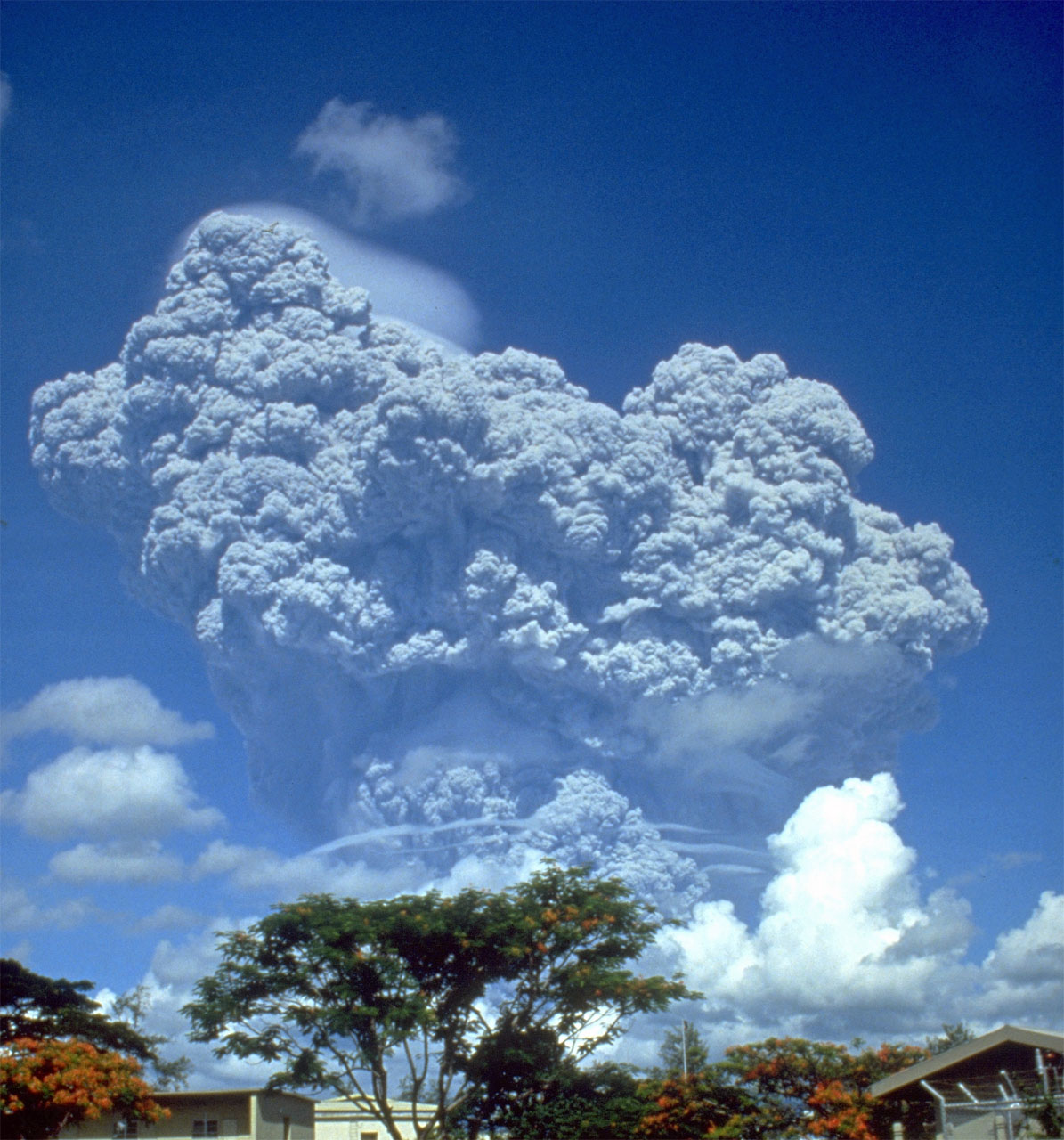 The Eruption of Mt. Pinatubo in 1991, on the Philippine island of Luzon, was the second largest volcanic eruption of the 20th century.
The geographical location of the Philippines makes it extremely vulnerable to typhoons. The Philippines lies directly on the path of the typhoon belt in the northwestern Pacific Ocean. As a result of this the area surrounding the Philippines is visited by an average of 20 typhoons per year with about 6 – 9 storms actually making landfall.
The Philippines also lies directly on the Pacific Ring of Fire. This results in the Philippines also being extremely vulnerable to earthquakes and volcanic eruptions, in addition to the danger from typhoons.
The Pacific Typhoon Belt
- Click here to return to the opening view of Typhoon Krosa.
Typhoon Krosa was a fairly typical example of one of the many typhoons that affect the Philippines every year.
- Click on each date below in order to see a high resolution satellite image tracking the progress of Typhoon Krosa:
- On what part of the Philippines did Krosa make landfall? Typhoon Krosa just grazed the very top of the northern Philippines. (Typhoon Haiyan, on the other hand, went right through the center of the Philippines.)
Typhoons Krosa and Haiyan both followed a track in the northwestern Pacific that placed them directly in the Pacific typhoon belt.
- Click here to see an overview of the total number of typhoons in the northwest Pacific between 1982 – 2009.
- What colors signify areas of extremely high storm activity? Yellow and red signify areas of extremely high storm activity.
- Are the Philippine islands in an area of high storm activity? Central and northern Philippines are both definitely in areas of extremely high storm activity.
- In what area does the highest storm activity occur? The area immediately east of central and northern Philippines has the highest storm activity.
The area enclosed by the color blue marks the typhoon belt in the northwestern Pacific.
- Rotate the globe to the northeastern Pacific. (Click here if you need help with this.)
- What do you notice? There is another typhoon belt off the western coast of Central America.
- Which part of the Pacific do you think has the most active typhoon area? The much larger area of the typhoon belt in the northwestern Pacific makes it the most active area in the Pacific (as well as the world). (The northeastern Pacific is the second most active typhoon area in the world, but it has the highest number of storms per unit area.)
- Click here to see a flat map view of typhoons/hurricanes around world.
- What is unusual about the area surrounding the equator? No typhoons/hurricanes occur in the area immediately surrounding the equator. As a matter of fact, long term observations show that no typhoons/hurricanes form within 5° of the equator.
- Attempt to explain this unusual phenomenon. Typhoons/hurricanes form when air rotates around a low pressure center. Coriolis force (i.e. the deflection of air currents caused by the Earth’s rotation) is too weak near the equator to cause air columns to rotate.
A Bad Spot
The physical location of the Philippines makes it more exposed to typhoons than any other large country in the world.